Delineation of flood-prone areas in cliffed coastal regions through a procedure based on the geomorphic flood index
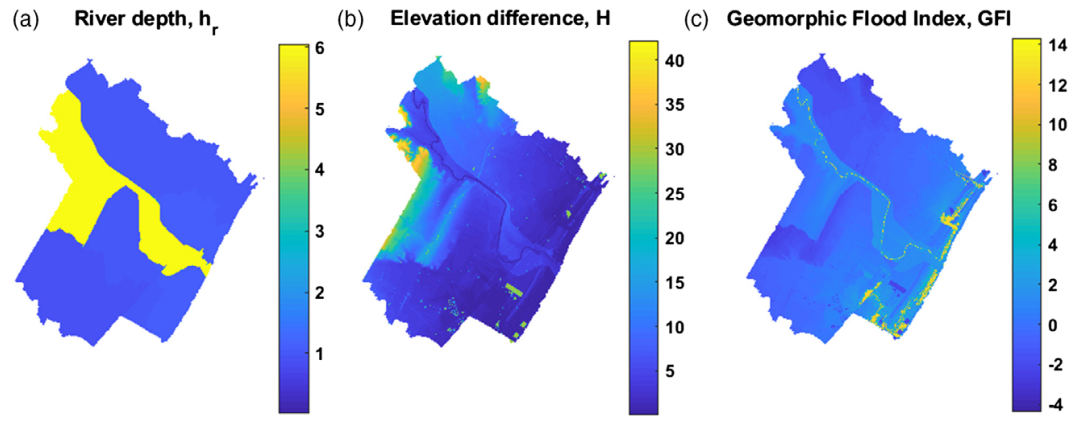
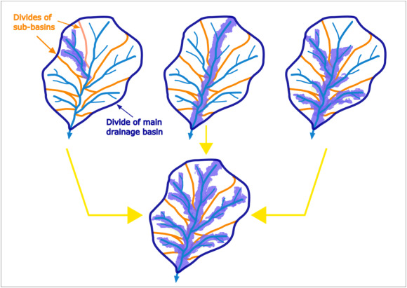
The geomorphic flood index (GFI) method provides a good representation of flood-prone areas. However, the method does not account for floodwater transfers in undefined interbasins (UIBs), which represent intercluded small…