Strategie -integrate per la PRevenzione e il monitoraggio del RIschio incendi
Scope: In recent years Basilicata Region has been affected by numerous fire events and many of these have interested areas under severe protection laws. The National Park of Appennino Lucano Val d’Agri Lagonegro in Basilicata represents an important biodiversity reservoir to be protected and safeguarded; it is under severe control measures by regional and national institutions. In this study it represents an optimal “test site” for fire monitoring through the use of innovative methodologies and tools for scientific communities. Among the most currently instruments used for these purposes, Remote Sensing is of course one of the most suitable as it allows to obtain, on a large scale and in a very broad spectrum of analysis, qualitative and quantitative information on the environment and objects by means of electromagnetic radiation measurements by using a remote sensor.
The use of remote techniques is widespread and concern a variety of topics. The effort regards their use is related to the requirement of careful processing for correcting geometric, radiometric errors and the effects of cloud cover.
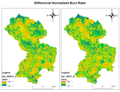
The aim of the project is the definition of an integrated, exportable and low-cost methodology that allows pro-active monitoring of the fire risk in protected areas by using open source data from satellite; thanks to remote data, and with the definition of vegetation indices calibrated on the ground data, it will be possible to quickly identify the burned areas and quantify the burn severity. The multi temporal analysis of satellite images will also allow to estimate the natural recovery capacity of the burned areas and therefore, the resilience levels of the various plant formations. The proposed approach will provide important suggestions on the eventual need for restore /recovery procedure of the affected areas, on the times and operating methods in relation to the vegetation types affected.
Partners: Centro di Geomorfologia Integrata per l’Area del Mediterraneo (CGIAM); University of Basilicata – Dipartimento delle Culture Europee e del Mediterraneo (DICEM); Fondazione Ambiente Ricerca Basilicata (FARBAS); Parco Nazionale Appennino Lucano Val d’Agri Lagonegro (PAL)
Research group:
Prof. Salvatore Manfreda, Scientific Coordinator of the DICEM research group.
Ph.D. Teresa Pizzolla, PostDoctoral Researcher, expert in environmental analysis and modeling.
Ph.D. Luciana Giuzio, Project collaborator, expert on hydrogeological and hydraulic risk analysis and modeling.
Activities:
Deliverables:
Project sheet : https://www.esperienzeconilsud.it/sprint/scheda-del-progetto/
Project funder: https://www.fondazioneconilsud.it/
Budget: 260.000,00 €
