Planning the future of Harmonious
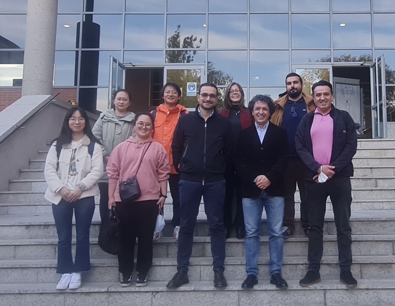
The Department of Topography and Cartography of the Technical University of Madrid hosted our work group meeting of COST Action – HARMONIOUS from 27 up to the 30 of October.…
Università degli Studi di Napoli Federico II - DICEA
The Department of Topography and Cartography of the Technical University of Madrid hosted our work group meeting of COST Action – HARMONIOUS from 27 up to the 30 of October.…
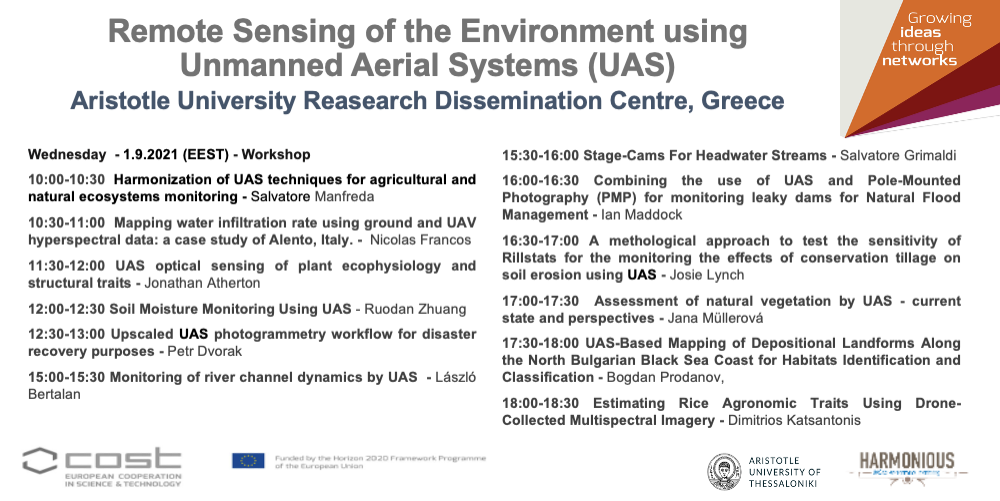
The next Generally Assembly entitled Remote Sensing of the Environment using Unmanned Aerial Systems (UAS) of the Harmonious Cost Action will be on live streaming https://auth.gr/video/29478 Program 9:00-9:30 Registration and…
Research and innovation driving transformative change. Becoming the world’s first climate-neutral continent by 2050, Europe needs to modernize the approach to engineering design, to ensure an inclusive ecological transition. Research…
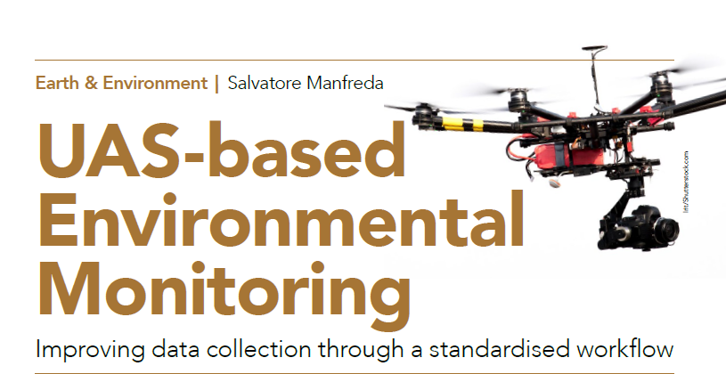
Unmanned Aerial Systems (UAS) play an increasingly important role in collecting data for environmental monitoring. The primary challenges for UAS in environmental studies include creating consistent, standardised guidelines for data…
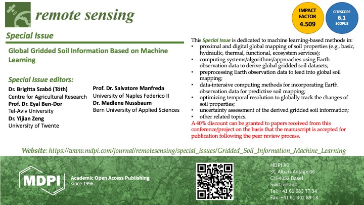
This Special Issue is dedicated to machine learning-based methods in:•proximal and digital global mapping of soil properties (e.g., basic, hydraulic, thermal, functional, ecosystem services);•computing systems/algorithms/approaches using Earth observation data to…
Can you tell us how you started working on using UASs for environmental monitoring? What was your motivation, and what did you find the most interesting in this research field?…

I would like to wish you all a Happy Easter of Resurrection. After this long period of difficulties, I hope that this will really be a reborn for a new…
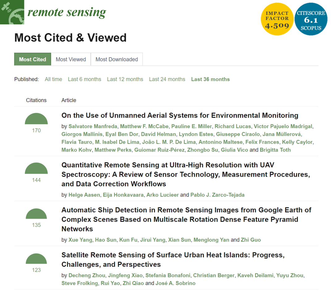
The review “On the Use of Unmanned Aerial Systems for Environmental Monitoring” by HARMONIOUS Team is the most cited paper of Remote Sensing MDPI in the last 36 months.
This year, COST Action – HARMONIOUS members produced a quite impressive number of results working online. Imagine what we could do without restrictions!See the following list:1. Use of UAVs with…
We are promoting a new research topic entitled Advances in Hydrological Monitoring with Unmanned Aerial Systems in Frontiers in Remote Sensing. FRONTIERS IN REMOTE SENSING Abstract Submission by March 2021Manuscript…

I would like to wish the merriest of Christmas to all HydroLAB members and friends, and I wish you happiness and prosperity in the year ahead.
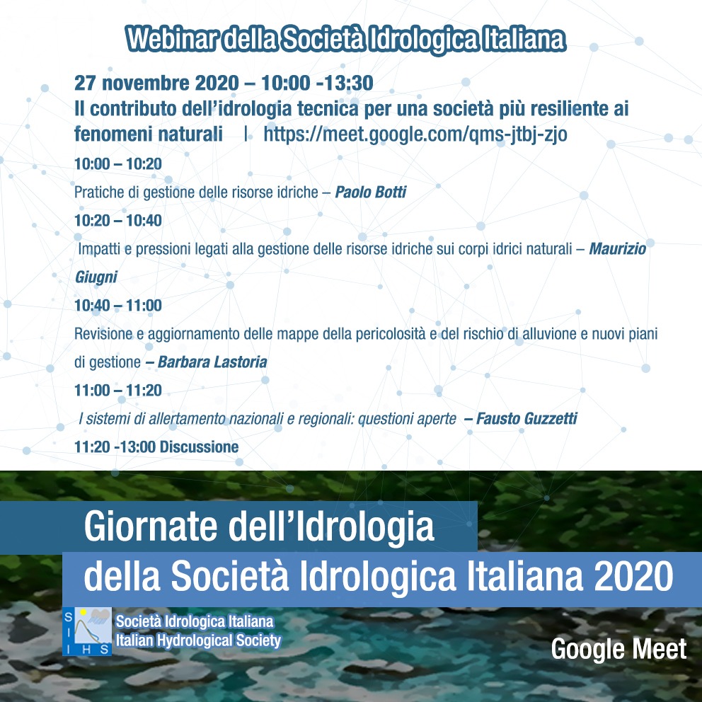
https://meet.google.com/qms-jtbj-zjo 10:00 – 10:20 – I sistemi di allertamento nazionali e regionali: questioni aperte – Fausto Guzzetti (Dirigente Dipartimento Protezione Civile) 10:20 – 10:40 – Impatti e pressioni legati alla…
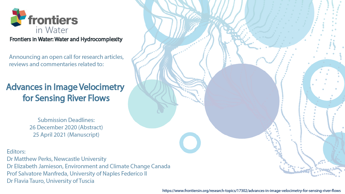
This Research Topic seeks to publish articles that demonstrate the utility of image velocimetry techniques for sensing the fluvial environment; that advance the development of image-based techniques; and inform deployment…
Climate change and landuse transformations have induced an increased flood risk worldwide. These phenomena are impacting dramatically on ordinary life and economy. Research and technology offer new strategy to quantify…

Il Dipartimento di Ingegneria Civile, Edile e Ambientale (DICEA) dell’Università degli Studi di Napoli Federico II ha recentemente bandito 45 borse di studio per giovani studenti neolaureati e dottori di…