Month: January 2017
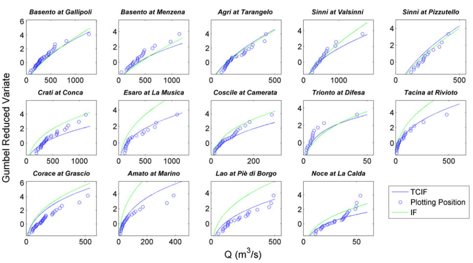
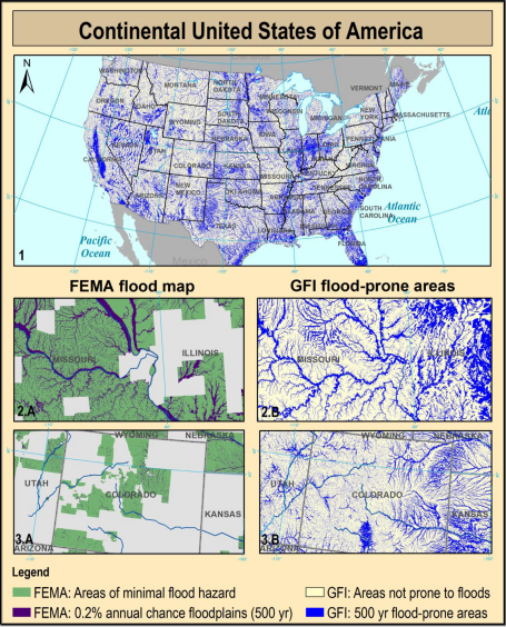
Knowing the location and the extent of the areas exposed to flood hazards is essential to any strategy for minimizing the risk. Unfortunately, in ungauged basins the use of traditional floodplain mapping techniques is prevented…
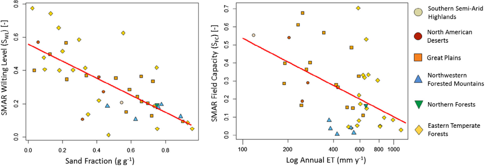
Satellite-based near-surface (0–2 cm) soil moisture estimates have global coverage, but do not capture variations of soil moisture in the root zone (up to 100 cm depth) and may be biased with respect to ground-based…
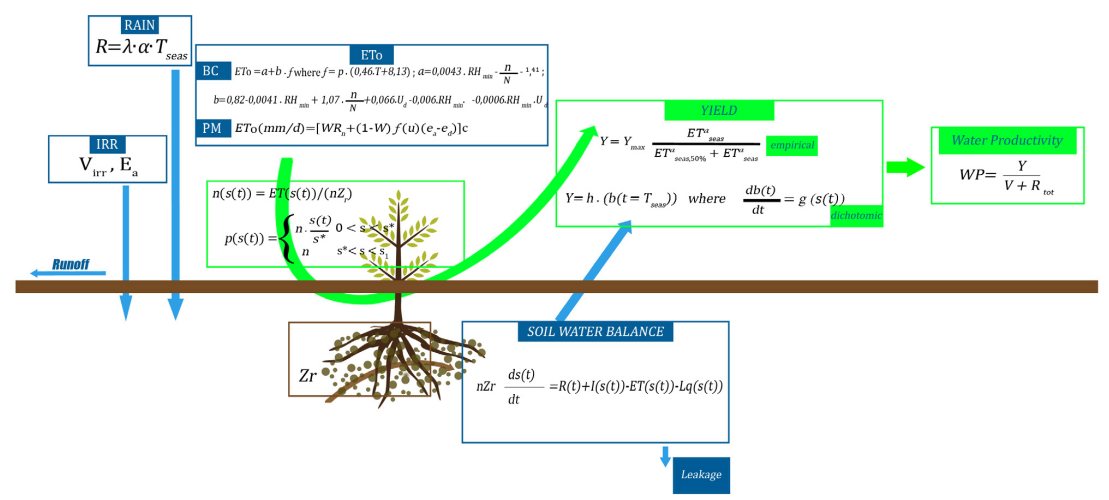
The paper introduces a minimalist water-driven crop model for sustainable irrigation management using an eco-hydrological approach. Such model, called MY SIRR, uses a relatively small number of parameters and attempts to balance simplicity, accuracy, and…
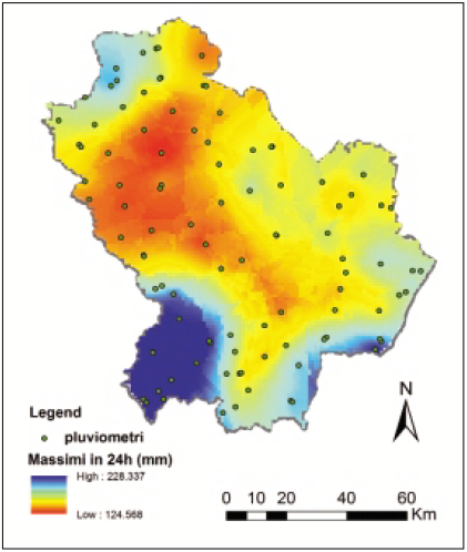
In the last few years, the scientific community has developed several hydrological models aimed at the simulation of hydrological processes acting at the basin scale. In this context, the portion of peak runoff contributing areas…
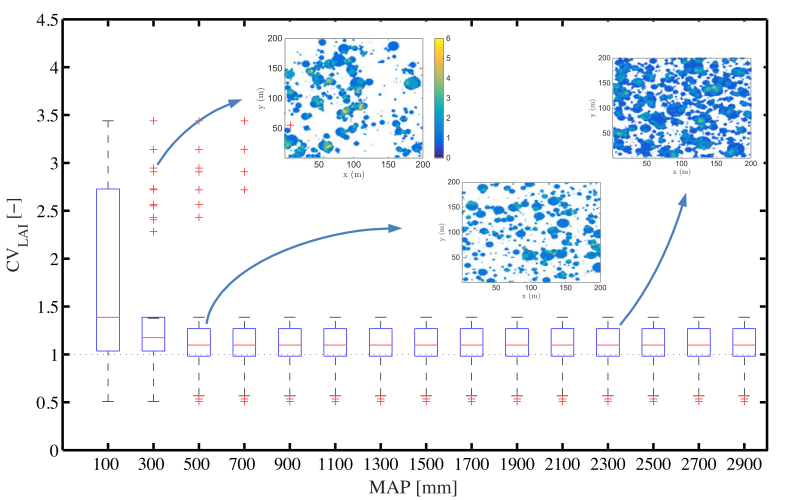
Spatial patterns found in vegetated ecosystems exhibit different degrees of organization in stand density that can be interpreted as an indicator of ecosystem health. In semiarid environments, it is possible to observe transitions from over-dispersed…