Special issue on Remote Sensing
It is with great pleasure that we invite you to contribute to a Special Issue in the journal Remote Sensing is dedicated to UAS-based studies focusing on environmental monitoring. Particularly,…
Università degli Studi di Napoli Federico II - DICEA
It is with great pleasure that we invite you to contribute to a Special Issue in the journal Remote Sensing is dedicated to UAS-based studies focusing on environmental monitoring. Particularly,…
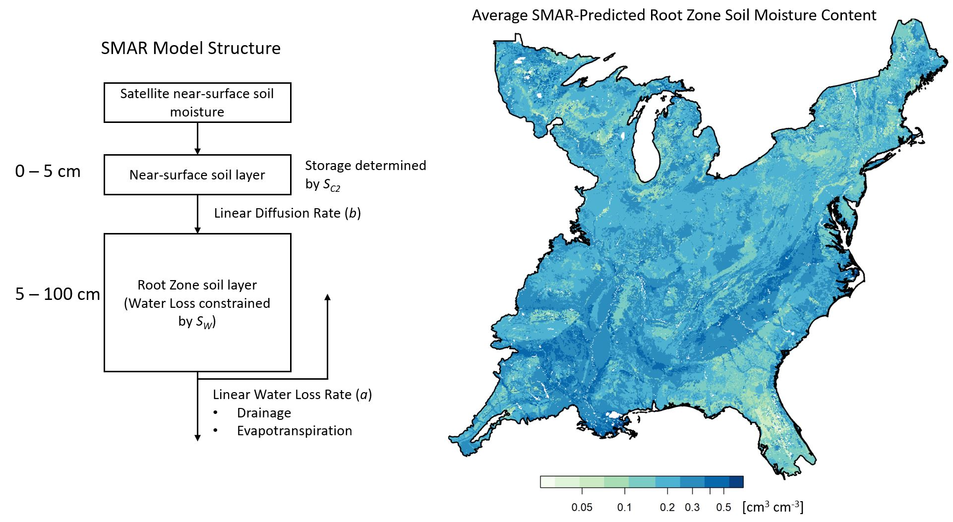
Root zone soil moisture (RZSM) affects many natural processes and is an important component of environmental modeling, but it is expensive and challenging to monitor for relatively small spatial extents.…
L’intervista di T3 Innovation Basilicata – Link In Basilicata è nota l’attenzione per i sistemi di monitoraggio ambientale e la prevenzione dei rischi idrogeologici considerando l’articolata costituzione geografica del territorio.…
La sottomissione degli Abstracts per le Giornate dell’Idrologia della SII 2019 è stata posticipata al 27 luglio. La Società Idrologica Italiana (SII) festeggia questo anno i suoi 10 anni dalla…

Workshop “Standardization of procedures in using UAS for environmental monitoring” Date: 6 November, 2019 Venue: Department of Civil Engineering, University of Coimbra (Coimbra, Portugal) We are pleased to inform that…
Environmental monitoring plays a central role in diagnosing climate and management impacts on natural and agricultural systems; enhancing the understanding of hydrological processes; optimizing the allocation and distribution of water…
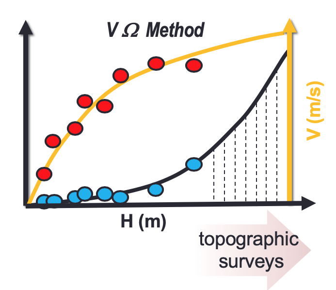
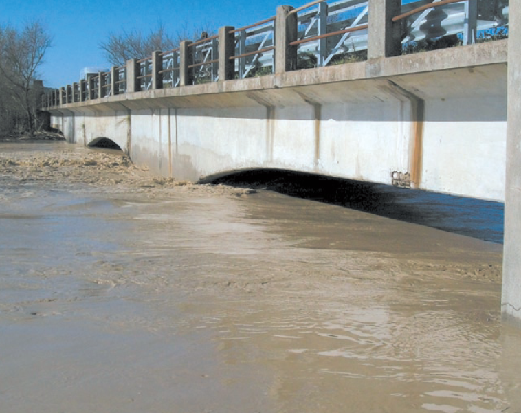
River monitoring is a critical issue for hydrological modelling that relies strongly on the use of flow rating curves (FRCs). In most cases, these functions are derived by least-squares fitting…
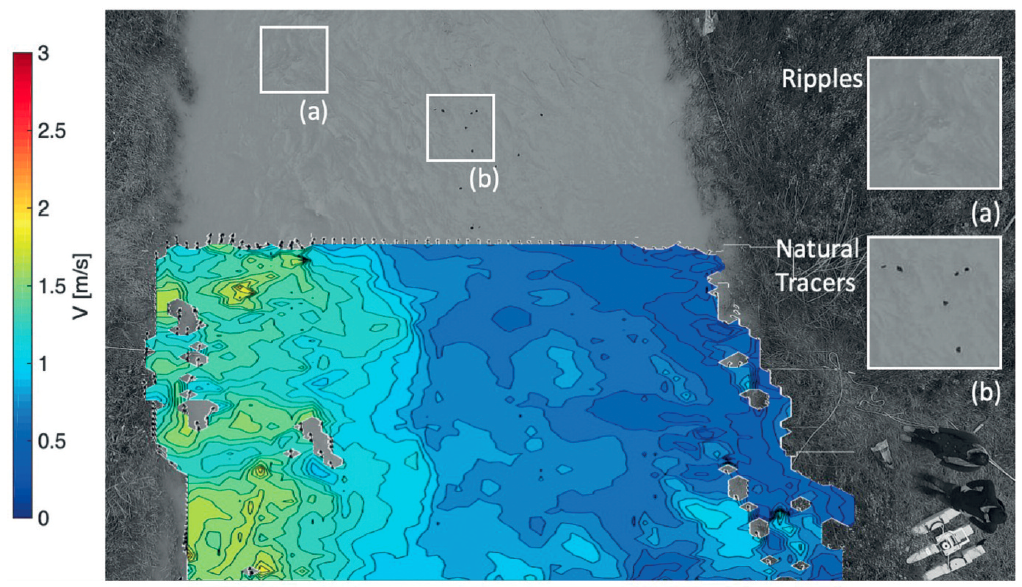
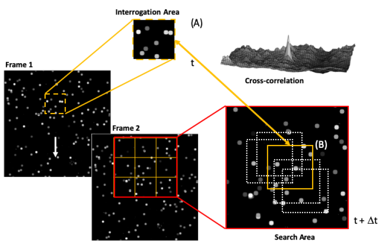
Advances in flow monitoring are crucial to increase our knowledge on basin hydrology and to understand the interactions between flow dynamics and infrastructures. In this context, image processing offers great…

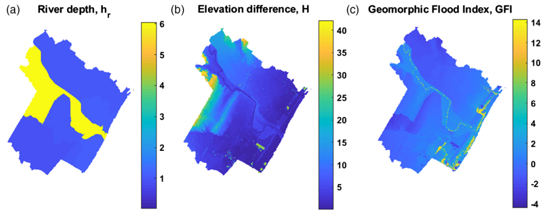
GFA – tool is an open-source QGIS plug-in to realize a fast and cost-effective delineation of the floodplains in the contexts where the available data is scarce to carry out…
Monitoring Surface Soil Moisture (SSM) and Root Zone Soil Moisture (RZSM) dynamics at the regional scale is of fundamental importance to many hydrological and ecological studies. This need becomes even…
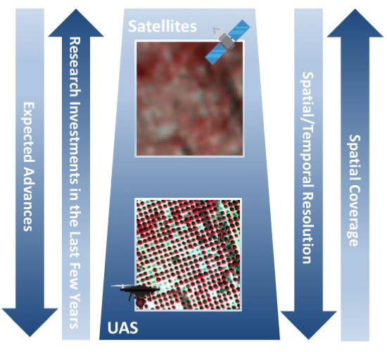
Traditional monitoring approaches are unlikely to provide the level of detail required to advance our understanding and description of the underlying physical processes and mechanisms for both technical and economical…
In recent years, the acquisition of data from multiple sources, together with improvements in computational capabilities, has allowed to improve our understanding on natural hazard through new approaches based on…
Data, and its timely delivery, presents one of the major constraints in advancing the hydrological sciences. Traditional monitoring techniques are time consuming, expensive, and discontinuous in space and time. Moreover,…
La stima della massima portata al colmo ovvero della massima pioggia corrispondente ad un prefissato tempo di ritorno rappresenta un elemento indispensabile per poter procedere ad un corretto programma di…
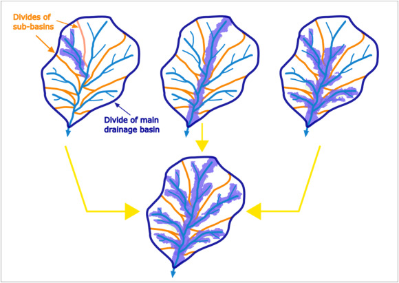
Delineation of flood hazard and flood risk areas is a critical issue, but practical difficulties regularly make complete achievement of the task a challenge. In data-scarce environments (e.g. ungauged basins,…