
Tag: UAS
River streamflow monitoring is currently facing a transformation due to the emerging of new innovative technologies. Fixed and mobile measuring systems are capable of quantifying surface flow velocities and discharges, relying on video acquisitions. This…
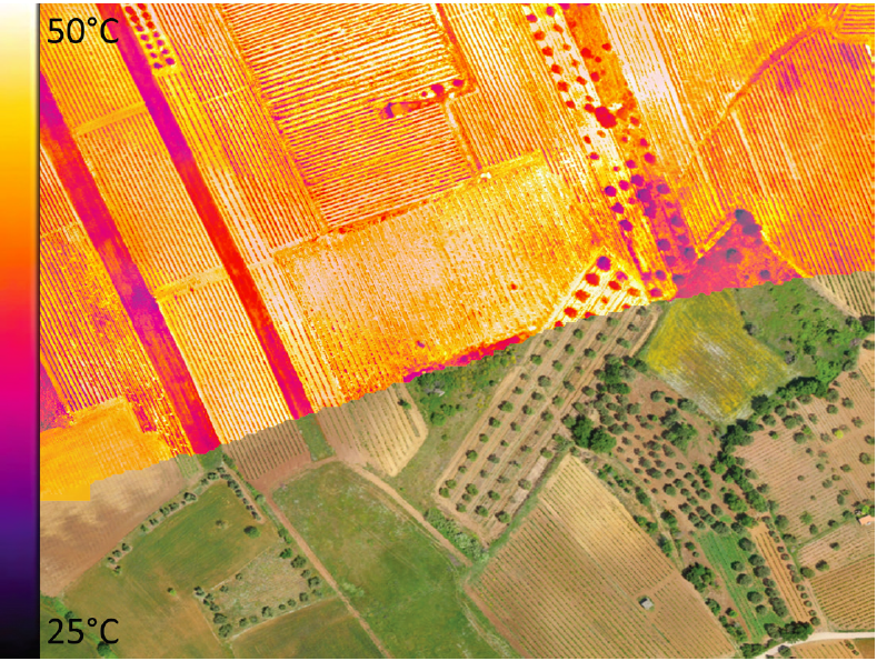
Thermal inertia has been applied to map soil water content exploiting remote sensing data in the short and long wave regions of the electromagnetic spectrum. Over the last years, optical and thermal cameras were sufficiently…
Since the turn of the 21st century, image-based velocimetry techniques have become an increasingly popular approach for determining open-channel flow in a range of hydrological settings across Europe and beyond. Simultaneously, a range of large-scale…
River flow monitoring is essential for many hydraulic and hydrologic applications related to water resource management and flood forecasting. Currently, unmanned aerial systems (UASs) combined with image velocimetry techniques provide a significant low-cost alternative for…
The past decades have seen rapid advancements in space-based monitoring of essential water cycle variables, providing products related to precipitation, evapotranspiration, and soil moisture, often at tens of kilometer scales. Whilst these data effectively characterize…

This is the questionnaire developed by HARMONIOUS aimed at identifying the most urgent and important challenges drone-based science will probably face in the near future. All UAS users are encouraged to participate on this short survey.
With the increasing role that unmanned aerial systems (UAS) are playing in data collection for environmental studies, two key challenges relate to harmonizing and providing standardized guidance for data collection, and also establishing protocols that…
Image velocimetry has proven to be a promising technique for monitoring river flows using remotely operated platforms such as Unmanned Aerial Systems (UAS). However, the application of various image velocimetry algorithms has not been extensively…

HARMONIOUS Training Course 2020 – Villach, 26.-29.2 2020 COST Action HARMONIOUS is organizing a Training Course on UAS-based moitoring of Natural and Agricultural Ecosystems. Program: Preprocessing of the UAS data Flight planning and data preprocessing Radiometric…

Small Unmanned Aircraft Systems can access hazardous or inaccessible areas during disaster events and provide rapid response. This is the first book that brings together the best practices of sUAS applied to a broad range…
Il monitoraggio rappresenta la principale fonte di conoscenza nelle scienze ambientali. I recenti progressi nelle tecnologie nell’ambito dell’Osservazione della Terra offrono molteplici possibilità per il monitoring e la tutela ambientale. I Sistemi Aeromobili a Pilotaggio…

It is with great pleasure that we invite you to contribute to a Special Issue in the journal Remote Sensing is dedicated to UAS-based studies focusing on environmental monitoring. Particularly, we welcome contributions with: Added…

L’intervista di T3 Innovation Basilicata – Link In Basilicata è nota l’attenzione per i sistemi di monitoraggio ambientale e la prevenzione dei rischi idrogeologici considerando l’articolata costituzione geografica del territorio. Oltre alle tecniche di telerilevamento…

Small unmanned aerial systems (UASs) equipped with an optical camera are a cost-effective strategy for topographic surveys. These low-cost UASs can provide useful information for three-dimensional (3D) reconstruction even if they are equipped with a…

Workshop “Standardization of procedures in using UAS for environmental monitoring” Date: 6 November, 2019 Venue: Department of Civil Engineering, University of Coimbra (Coimbra, Portugal) We are pleased to inform that the next Workshop of the…