
Author: Salvatore Manfreda
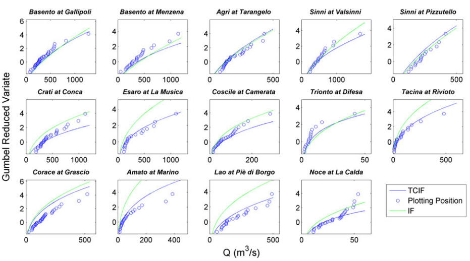
In the last few years, the scientific community has developed several hydrological models aimed at the simulation of hydrological processes acting at the basin scale. In this context, the portion of peak runoff contributing areas…
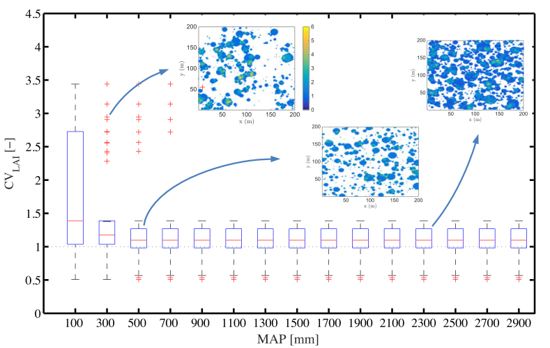
Spatial patterns found in vegetated ecosystems exhibit different degrees of organization in stand density that can be interpreted as an indicator of ecosystem health. In semiarid environments, it is possible to observe transitions from over-dispersed…

The time-dependent bridge pier scour during flood waves is analysed. Scour experiments were conducted in a novel installation able to produce complex hydrographs with high precision. Experimental data were used to test scour formulas including…

Estimation of root-zone soil moisture (RZSM) at regional scales is a critical issue in surface hydrology that could be a great help for estimating evapotranspiration, erosion, runoff, and irrigation requirements, etc. A significant number of…

The Sassi of Matera are now considered a masterpiece of architecture and engineering, but it was a national shame for the level of degradation reached in the last century. Cave churches, excavations in the rocks,…
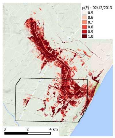
Accurate flood mapping is important for both planning activities during emergencies and as a support for the successive assessment of damaged areas. A valuable information source for such a procedure can be remote sensing synthetic…

Soil moisture is a variable of paramount importance for a number of natural processes and requires the capacity to be routinely measured at different spatial and temporal scales (e.g., hillslope and/or small catchment scale). The…
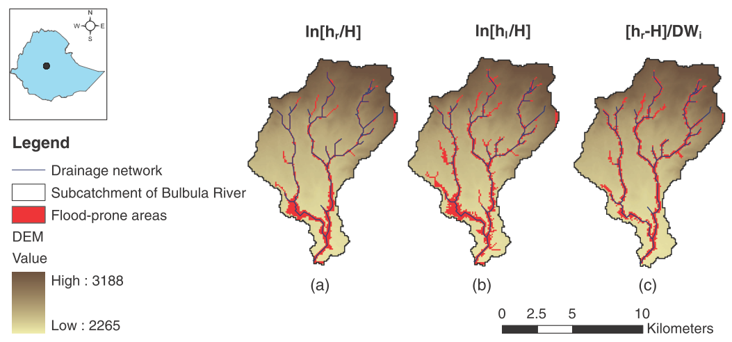
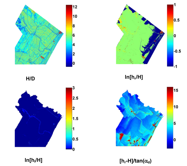
In the present work, the flood hazard exposure in an ungauged basin in Africa is assessed exploiting the basin morphological characteristics. Flood-prone areas are identified using linear binary classifiers based on several geomorphic descriptors extracted…
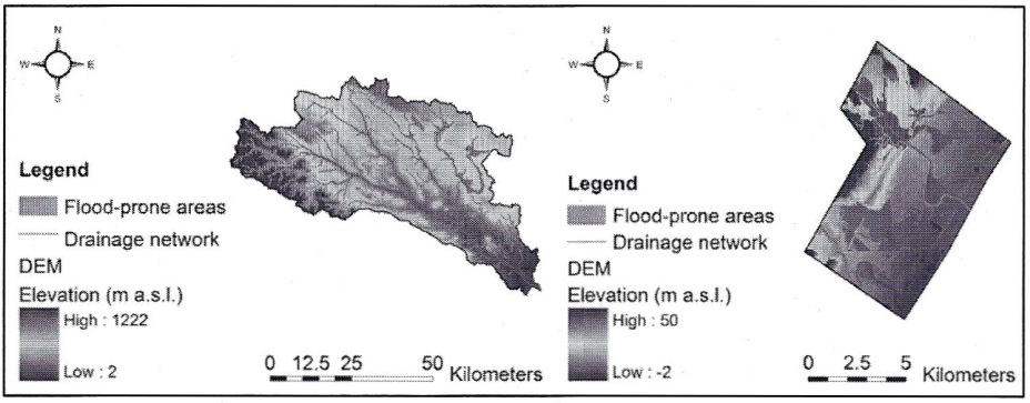
The identification of flood-prone areas is a critical issue becoming everyday more pressing for our society. A preliminary delineation can be carried out by DEM-based procedures that rely on basin geomorphologic features. In the present…
L’individuazione delle aree inondabili è un problema cruciale che, col passare del tempo, sta diventando sempre più impattante sulla nostra società. Una delimitazione preliminare può essere effettuata mediante procedure basate sull’analisi della geomorfologia del bacino,…
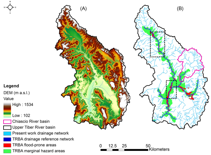
Three different geomorphic approaches to the identification of flood prone areas are investigated by means of a comparative analysis of the input parameters, the performances and the range of applicability. The selected algorithms are: the…

In the present work, we developed a new formulation for the estimation of the soil moisture in the root zone based on the measured value of soil moisture at the surface. It was derived from…

The present paper describes a hydrological model aimed at improving prediction systems for a hydropower production plant. A significant merit of the work lies in the model structure that incorporates physically based processes allowing a…

Society is facing growing environmental problems that require new research efforts to understand the way ecosystems operate and survive, and their mutual relationships with the hydrologic cycle. In this respect, ecohydrology suggests a renewed interdisciplinary…

In the present paper, an analytical work for the description of the soil water balance and runoff production was adopted over a significant number of river basins belonging to a humid region of Southern Italy.…