
Tag: Remote sensing
Satellite remote sensing is a highly valuable data source useful in the monitoring of surface water dynamics and an essential tool in flood risk management although several factors can interfere with the detection of water…
This study suggests a rapid methodology to delineate areas prone to flood using machine learning techniques. Based on available historically flooded areas, the model employs and combines globally collectible and reproducible conditioning factors to analyze…
VISION is open-source software written in MATLAB for video stabilisation using automatic features detection. It can be applied for any use, but it has been developed mainly for image velocimetry applications in rivers. It includes…

I’m proud to announce that our recent paper “Current Practices in UAS-based Environmental Monitoring” has been awarded with the Best Paper Award 2022 by Remote Sensing MDPI. This paper has been the result of a joint…
Soil moisture (SM) is a connective hydrological variable between the Earth’s surface and atmosphere and affects various climatological processes. Surface soil moisture (SSM) is a key component for addressing energy and water exchanges and can…
The inherent biases of different long-term gridded surface soil moisture (SSM) products, unconstrained by the in situ observations, implies different spatio-temporal patterns. In this study, the Random Forest (RF) model was trained to predict SSM…
Ecosystem complexity is among the important drivers of biodiversity and ecosystem functioning, and unmanned aerial systems (UASs) are becoming an important tool for characterizing vegetation patterns and processes. The variety of UASs applications is immense,…

Dear Colleagues, Recent technological advances in both remote sensing and soil mapping approaches and progress in establishing harmonized soil profile datasets have opened up the potential to derive global gridded soil information. This has been…
The past decades have seen rapid advancements in space-based monitoring of essential water cycle variables, providing products related to precipitation, evapotranspiration, and soil moisture, often at tens of kilometer scales. Whilst these data effectively characterize…
It is crucial to monitor the dynamics of soil moisture over the Tibetan Plateau, while considering its important role in understanding the land-atmosphere interactions and their influences on climate systems (e.g., Eastern Asian Summer Monsoon).…
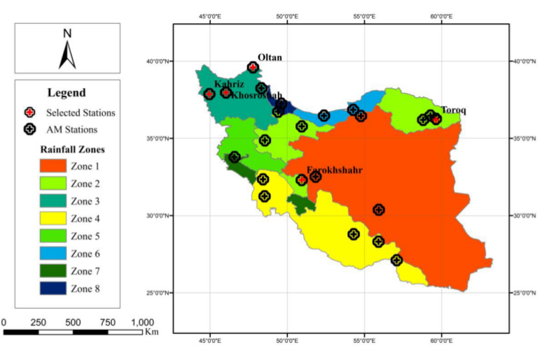
Monitoring Surface Soil Moisture (SSM) and Root Zone Soil Moisture (RZSM) dynamics at the regional scale is of fundamental importance to many hydrological and ecological studies. This need becomes even more critical in arid and…
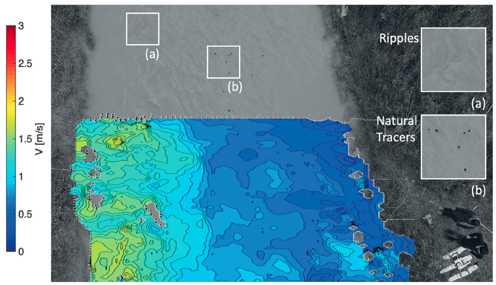
Data, and its timely delivery, presents one of the major constraints in advancing the hydrological sciences. Traditional monitoring techniques are time consuming, expensive, and discontinuous in space and time. Moreover, field observations are influenced by…
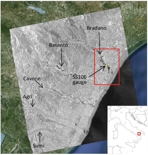
Producing high-precision flood maps requires integrating and correctly classifying information coming from heterogeneous sources. Methods to perform such integration have to rely on different knowledge bases. A useful tool to perform this task consists in…
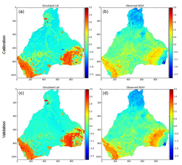
Ecohydrological modeling studies in developing countries, such as sub-Saharan Africa, often face the problem of extensive parametrical requirements and limited available data. Satellite remote sensing data may be able to fill this gap, but require…
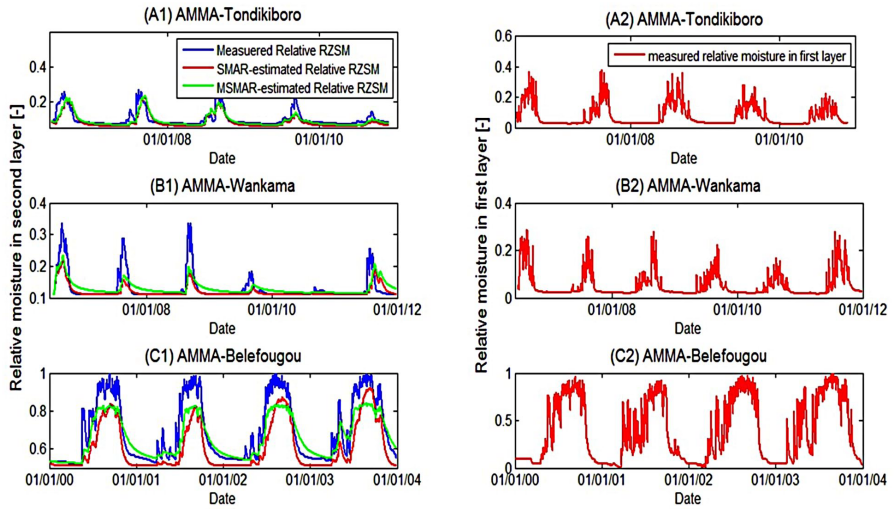
Root-zone soil moisture at the regional scale has always been a missing element of the hydrological cycle. Knowing its value could be a great help in estimating evapotranspiration, erosion, runoff, permeability, irrigation needs, etc. The…