
Tag: Geomorphic methods

Delineation of flood hazard and flood risk areas is a critical issue, but practical difficulties regularly make complete achievement of the task a challenge. In data-scarce environments (e.g. ungauged basins, large-scale analyses), useful information about flood…
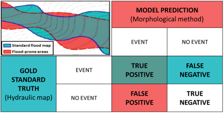
Knowing the location and the extent of areas exposed to floods is the most basic information needed for planning flood management strategies. Unfortunately, a complete identification of these areas is still lacking in many countries.…
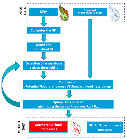
Delineation of flood hazard and flood risk areas is a critical issue, but practical difficulties regularly make complete achievement of the task a challenge. In data-scarce environments (e.g. ungauged basins, large-scale analyses), useful information about…
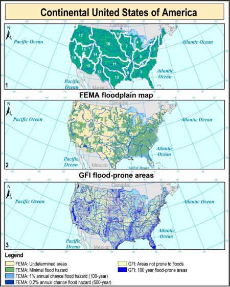
Efficient strategies for preparing communities to protect against,respond to, recover from, and mitigateflood hazard are oftenhampered by the lack of information about the position and extentofflood-prone areas. Hydrologic and hydraulic analyses allow toobtain detailedflood hazard…
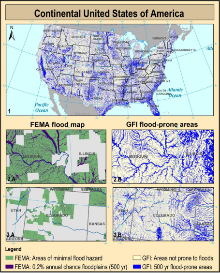
Knowing the location and the extent of the areas exposed to flood hazards is essential to any strategy for minimizing the risk. Unfortunately, in ungauged basins the use of traditional floodplain mapping techniques is prevented…
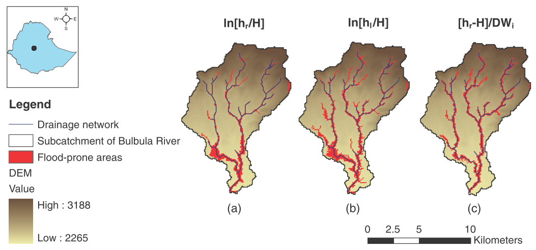
In the present work, the flood hazard exposure in an ungauged basin in Africa is assessed exploiting the basin morphological characteristics. Flood-prone areas are identified using linear binary classifiers based on several geomorphic descriptors extracted…
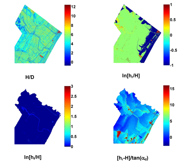
The identification of flood-prone areas is a critical issue becoming everyday more pressing for our society. A preliminary delineation can be carried out by DEM-based procedures that rely on basin geomorphologic features. In the present…
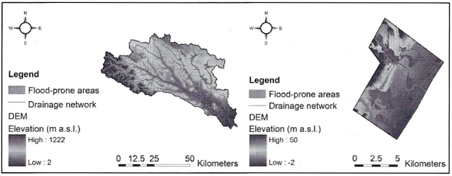
L’individuazione delle aree inondabili è un problema cruciale che, col passare del tempo, sta diventando sempre più impattante sulla nostra società. Una delimitazione preliminare può essere effettuata mediante procedure basate sull’analisi della geomorfologia del bacino,…
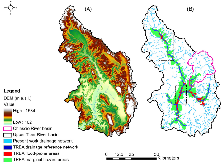
Three different geomorphic approaches to the identification of flood prone areas are investigated by means of a comparative analysis of the input parameters, the performances and the range of applicability. The selected algorithms are: the…
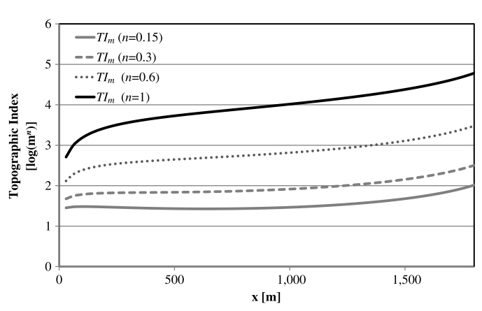
The discussers address a number of interesting questions on the original paper. The writers strongly believe that this kind of discussion represents an extraordinary opportunity to exchange ideas and comments on current research, helping both…

r.hazard.flood is an implementation of a fast procedure to detect flood prone areas. It is based on a simple procedure that exploits the correlation between flood exposure and a Modified Topographic Index (MTI), calculated on the…
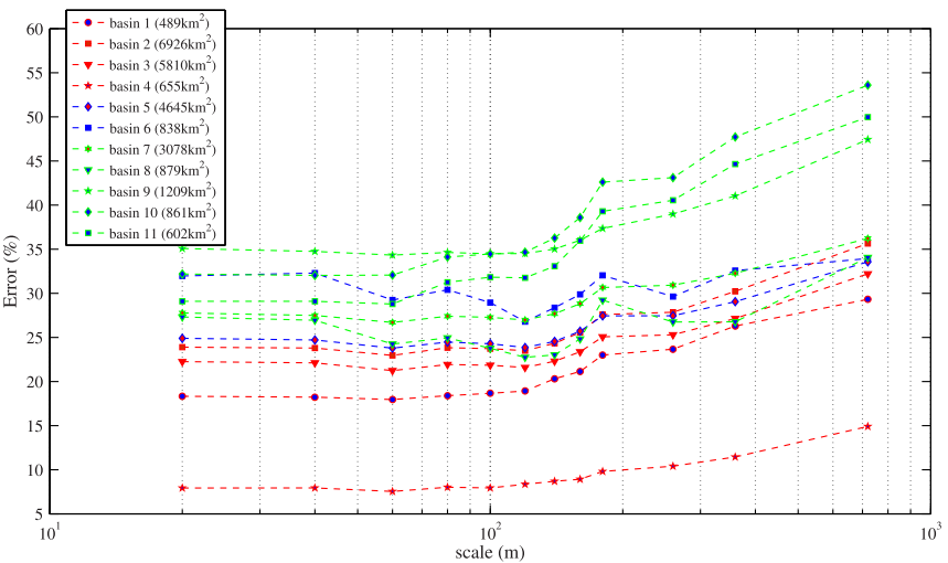
The availability of new technologies for the measurement of surface elevation has addressed the lack of high-resolution elevation data, which has led to an increase in the attraction of automated procedures based on digital elevation…
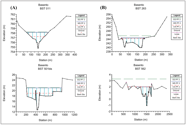
L’espressione “rischio idraulico” indica il pericolo di inondazione da parte di corsi d’acqua naturali o artificiali e definisce il manifestarsi di eventi di inondazione che producono danni misurabili a persone o cose (Frescura, 2007). Il…
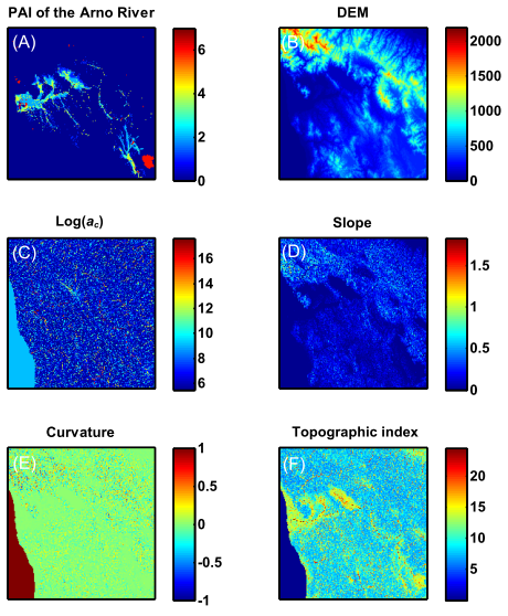
The present research was aimed to evaluate flooding exposure by exploiting the potential of morphological indices (e.g., drainage area, local slope, curvature, etc.). It was found that the areas exposed to flood inundation may be…
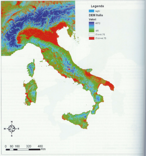
The objetive of the present research was the evaluation of the flood exposure of the Italian territory. For this reason, the national territory has been subdivided in national, interregional and regional catchments according to the…