
Category: Publications
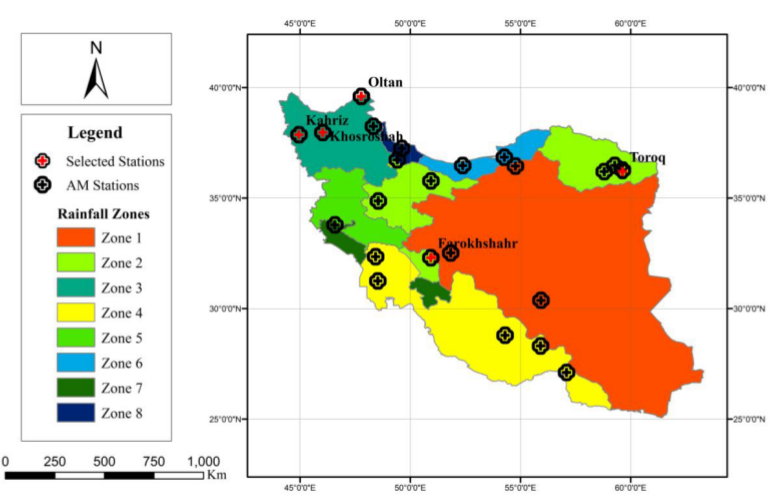
Monitoring Surface Soil Moisture (SSM) and Root Zone Soil Moisture (RZSM) dynamics at the regional scale is of fundamental importance to many hydrological and ecological studies. This need becomes even more critical in arid and…
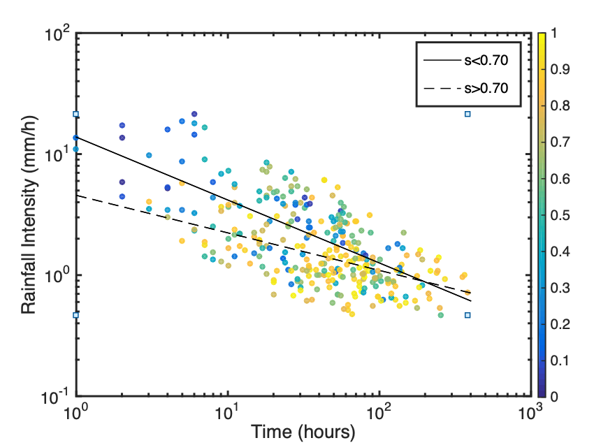
Rainfall-triggered shallow landslides have caused losses of human life and millions of euros in damage to property in all parts of the world. The need to prevent such phenomena combined with the difficulty to describe…
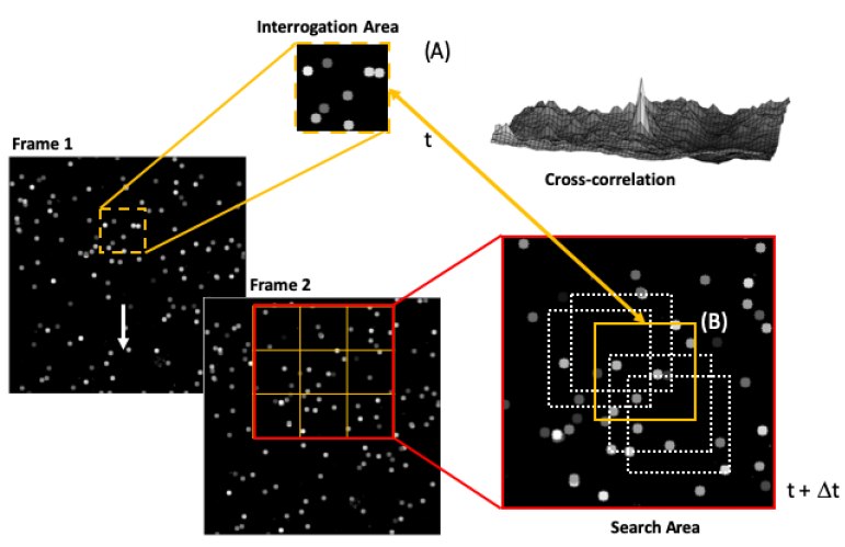
Traditional monitoring approaches are unlikely to provide the level of detail required to advance our understanding and description of the underlying physical processes and mechanisms for both technical and economical limitations (Manfreda and McCabe, 2019).…
In recent years, the acquisition of data from multiple sources, together with improvements in computational capabilities, has allowed to improve our understanding on natural hazard through new approaches based on machine learning and Big Data…
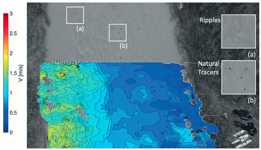
Data, and its timely delivery, presents one of the major constraints in advancing the hydrological sciences. Traditional monitoring techniques are time consuming, expensive, and discontinuous in space and time. Moreover, field observations are influenced by…

Based on recent contributions regarding the treatment of unsteady hydraulic conditions in the state-of-the-art scour literature, theoretically derived probability distribution of bridge scour is introduced. The model has been derived assuming a rectangular hydrograph shape…

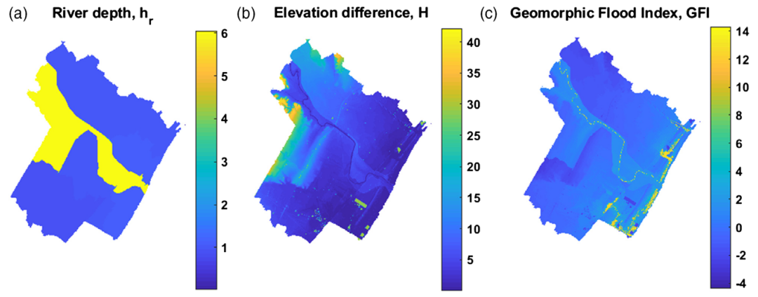
Delineation of flood hazard and flood risk areas is a critical issue, but practical difficulties regularly make complete achievement of the task a challenge. In data-scarce environments (e.g. ungauged basins, large-scale analyses), useful information about flood…
High and low flows and associated floods and droughts are extreme hydrological phenomena mainly caused by meteorological anomalies and modified by catchment processes and human activities. They exert increasing on human, economic, and natural environmental…

In hydrological modelling, the challenge is to identify an optimal strategy to exploit tools and available observations in order to enhance model reliability. The increasing availability of data promotes the use of new calibration techniques…

To promote the advancement of novel observation techniques that may lead to new sources of information to help better understand the hydrological cycle, the International Association of Hydrological Sciences (IAHS) established the Measurements and Observations…
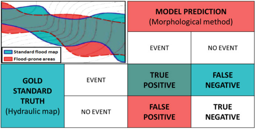
Knowing the location and the extent of areas exposed to floods is the most basic information needed for planning flood management strategies. Unfortunately, a complete identification of these areas is still lacking in many countries.…

Negli ultimi anni la comunità scientifica ha sviluppato differenti modelli idrologici finalizzati all’approfondimento dei processi a scala di bacino; in particolare differenti tipi di concettualizzazione sono stati utilizzati per descrivere la variabilità spaziale dello stato…
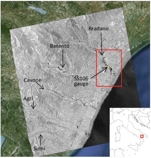
Producing high-precision flood maps requires integrating and correctly classifying information coming from heterogeneous sources. Methods to perform such integration have to rely on different knowledge bases. A useful tool to perform this task consists in…
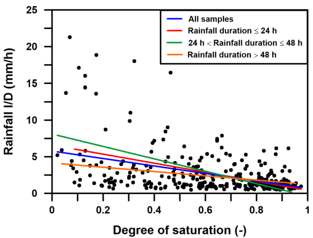
Rainfall-triggered shallow landslides have caused losses of human life and millions of euros in damage to property in all parts of the world. The need to prevent such phenomena combined with the difficulty to describe…
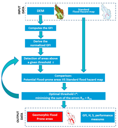
Delineation of flood hazard and flood risk areas is a critical issue, but practical difficulties regularly make complete achievement of the task a challenge. In data-scarce environments (e.g. ungauged basins, large-scale analyses), useful information about…