IAHS Academy
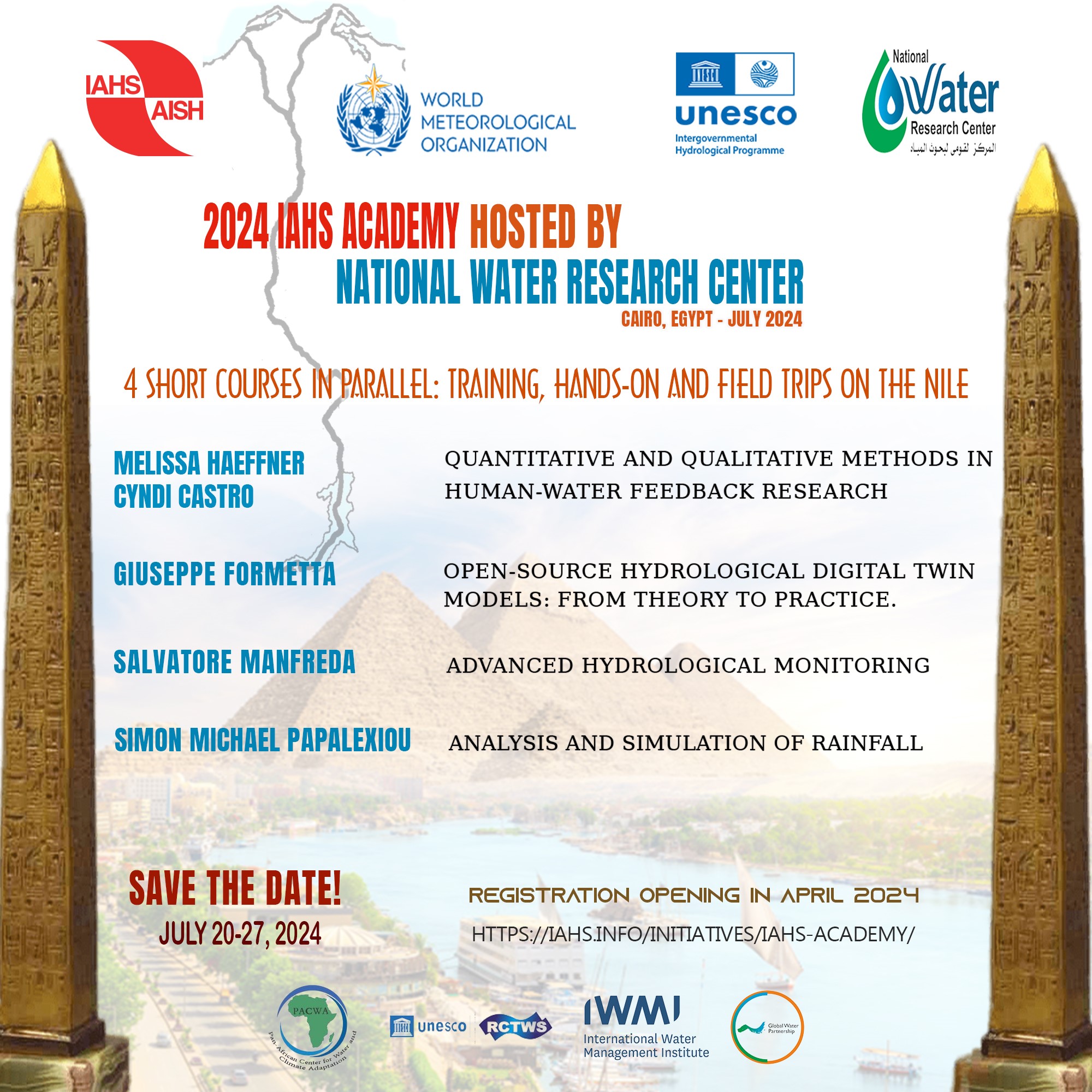
The IAHS – International Association of Hydrological Sciences is proud to announce dates (July 20-27, 2024) and Venue (Cairo, Egypt) of the first edition of the IAHS Academy, the newly…
Università degli Studi di Napoli Federico II - DICEA
The IAHS – International Association of Hydrological Sciences is proud to announce dates (July 20-27, 2024) and Venue (Cairo, Egypt) of the first edition of the IAHS Academy, the newly…
Satellite remote sensing is a highly valuable data source useful in the monitoring of surface water dynamics and an essential tool in flood risk management although several factors can interfere…
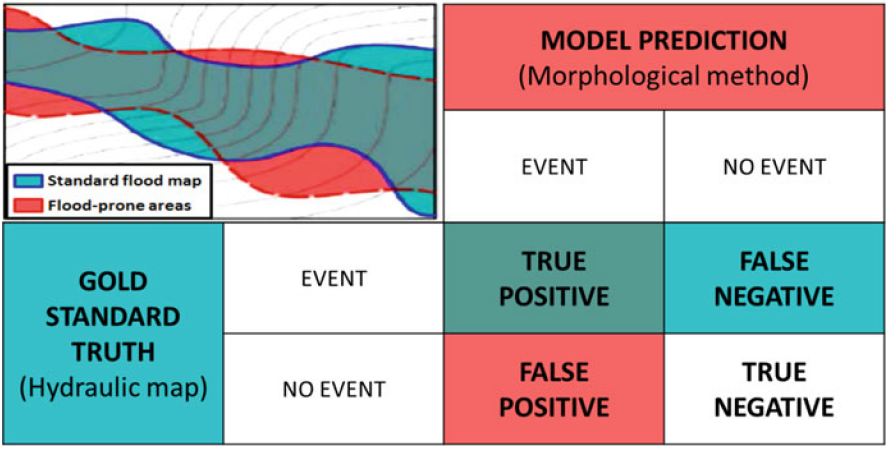
This study suggests a rapid methodology to delineate areas prone to flood using machine learning techniques. Based on available historically flooded areas, the model employs and combines globally collectible and…
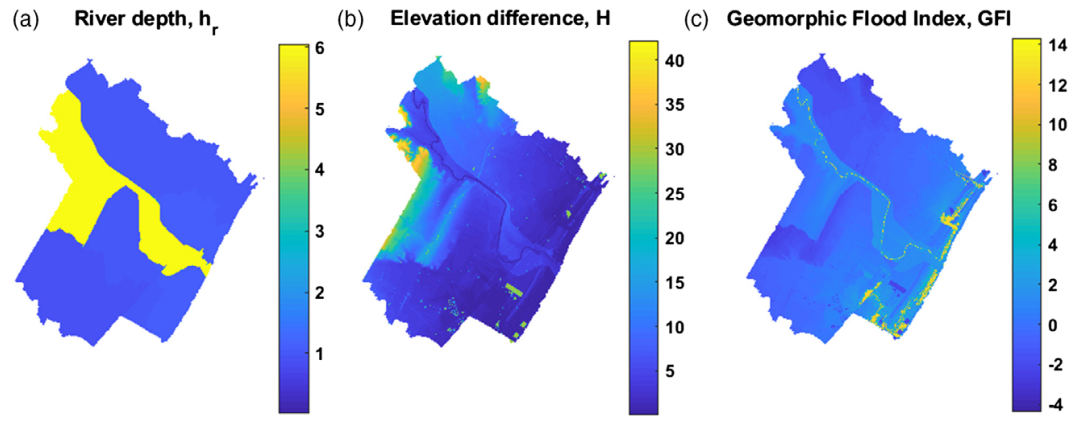
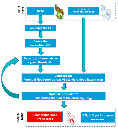
The geomorphic flood index (GFI) method provides a good representation of flood-prone areas. However, the method does not account for floodwater transfers in undefined interbasins (UIBs), which represent intercluded small…
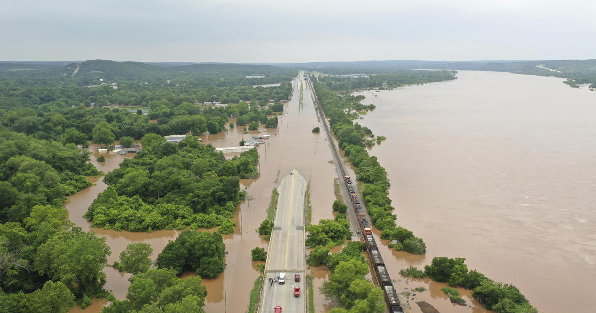
Climate change and landuse transformations have induced an increased flood risk worldwide. These phenomena are impacting dramatically on ordinary life and economy. Research and technology offer new strategy to quantify…
A topographic index (flood descriptor) that combines the scaling of bankfull depth with morphology was shown to describe the tendency of an area to be flooded. However, this approach depends…
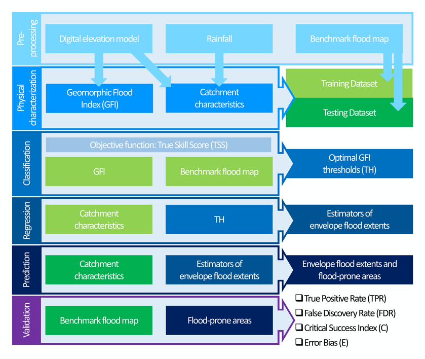
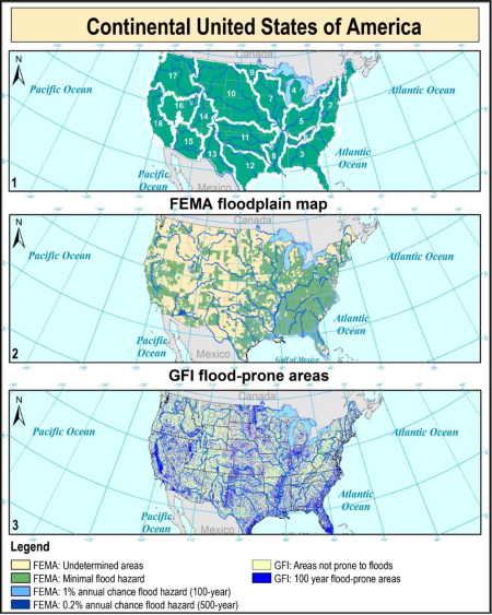
Large-scale flood risk assessment is essential in supporting national and global policies, emergency operations and land-use management. The present study proposes a cost-efficient method for the large-scale mapping of direct…
In recent years, the acquisition of data from multiple sources, together with improvements in computational capabilities, has allowed to improve our understanding on natural hazard through new approaches based on…
GFA – tool is an open-source QGIS plug-in to realize a fast and cost-effective delineation of the floodplains in the contexts where the available data is scarce to carry out…
The last decades have seen a massive advance in technologies for Earth Observation (EO) and environmental monitoring, which provided scientists and engineers with valuable spatial information for studying hydrologic processes.…
TEMA 2: IDROLOGIA DI LARGA SCALA – BIG DATA IN HYDROLOGY Il tema del Big Data offre nuove opportunità per l’avanzamento delle conoscenze data la crescente disponibilità di dati satellitari…
In recent years, the acquisition of data from multiple sources, together with improvements in computational capabilities, has allowed to improve our understanding on natural hazard through new approaches based on…
Knowing the location and the extent of areas exposed to floods is the most basic information needed for planning flood management strategies. Unfortunately, a complete identification of these areas is…
Delineation of flood hazard and flood risk areas is a critical issue, but practical difficulties regularly make complete achievement of the task a challenge. In data-scarce environments (e.g. ungauged basins,…
Efficient strategies for preparing communities to protect against,respond to, recover from, and mitigateflood hazard are oftenhampered by the lack of information about the position and extentofflood-prone areas. Hydrologic and hydraulic…