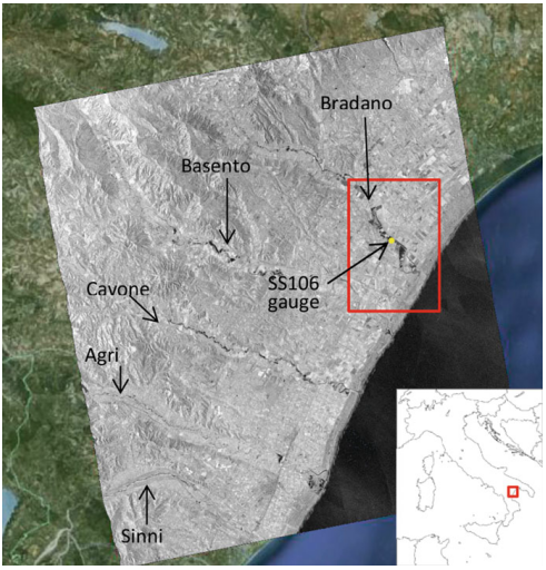
Producing high-precision flood maps requires integrating and correctly classifying information coming from heterogeneous sources. Methods to perform such integration have to rely on different knowledge bases. A useful tool to perform this task consists in the use of Bayesian methods to assign probabilities to areas being subject to flood phenomena, fusing a priori information and modeling with data coming from radar or optical imagery. In this chapter we review the use of Bayesian networks, an elegant framework to cast probabilistic descriptions of complex systems, applied to flood monitoring from multi-sensor, multi-temporal remotely sensed and ancillary data.
How to cite: Annarita D’Addabbo, Alberto Refice, Domenico Capolongo, Guido Pasquariello and Salvatore Manfreda, Data Fusion Through Bayesian Methods for Flood Monitoring from Remotely Sensed Data, Springer International Publishing AG 2018, Pages 181 – 208, (doi: https://doi.org/10.1007/978-3-319-63959-8_8), 2018. [pdf]