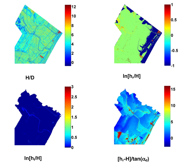
The identification of flood-prone areas is a critical issue becoming everyday more pressing for our society. A preliminary delineation can be carried out by DEM-based procedures that rely on basin geomorphologic features. In the present paper, we investigated the dominant topographic controls for the flood exposure using techniques of pattern classification through linear binary classifiers based on DEM-derived morphologic features. Our findings may help the definition of new strategies for the delineation of flood – prone areas with DEM-based procedures. With this aim, local features—which are generally used to describe the hydrological characteristics of a basin—and composite morphological indices are taken into account in order to identify the most significant one.
Analyses are carried out on two different datasets: one based on flood simulations obtained with a 1D hydraulic model, and the second one obtained with a 2D hydraulic model. The analyses highlight the potential of each morphological descriptor for the identification of the extent of flood-prone areas and, in particular, the ability of one geomorphologic index to represent flood-inundated areas at different scales of application.
How to cite: Manfreda, S., C. Samela, A. Gioia, G. Consoli, V. Iacobellis, L. Giuzio, A. Cantisani, A. Sole, Flood-Prone Areas Assessment Using Linear Binary Classifiers based on flood maps obtained from 1D and 2D hydraulic models, Natural Hazards, 79 (2), 735-754, (doi: 10.1007/s11069-015-1869-5), 2015. [pdf]