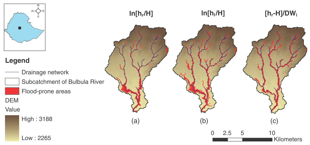
In the present work, the flood hazard exposure in an ungauged basin in Africa is assessed exploiting the basin morphological characteristics. Flood-prone areas are identified using linear binary classifiers based on several geomorphic descriptors extracted from digital elevation models (DEMs). The classifiers are calibrated individually and evaluated by comparing their outputs with a flood inundation map obtained by two-dimensional (2D) hydraulic simulations and using receiver operating characteristics (ROC) curves as performance measures. The best-performing descriptors for the subcatchment of the Bulbula River, near the city of Addis Ababa (Ethiopia), are the elevation difference, H between the location under exam and the nearest drainage network, and the composite index ln [ hr / H ], that compares an estimate of the water level in the nearest point of the river network to the difference in elevation between the point under exam and the river. These simple procedures allow extending the flood delineation derived with the hydraulic model over the entire river basin. The study highlights the potential for the detection of flood-prone areas over ungauged basins and large areas.

How to cite: Caterina Samela, Salvatore Manfreda, Francesco De Paola, Maurizio Giugni, Aurelia Sole and Mauro Fiorentino, DEM-Based Approaches for the Delineation of Flood-Prone Areas in an Ungauged Basin in Africa, Journal of Hydraulic Engineering (doi: 10.1061/(ASCE)HE.1943-5584.0001272), 2015. [pdf]