
Month: January 2018

To promote the advancement of novel observation techniques that may lead to new sources of information to help better understand the hydrological cycle, the International Association of Hydrological Sciences (IAHS) established the Measurements and Observations…
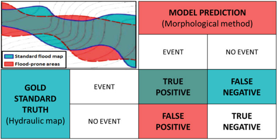
Knowing the location and the extent of areas exposed to floods is the most basic information needed for planning flood management strategies. Unfortunately, a complete identification of these areas is still lacking in many countries.…

Negli ultimi anni la comunità scientifica ha sviluppato differenti modelli idrologici finalizzati all’approfondimento dei processi a scala di bacino; in particolare differenti tipi di concettualizzazione sono stati utilizzati per descrivere la variabilità spaziale dello stato…
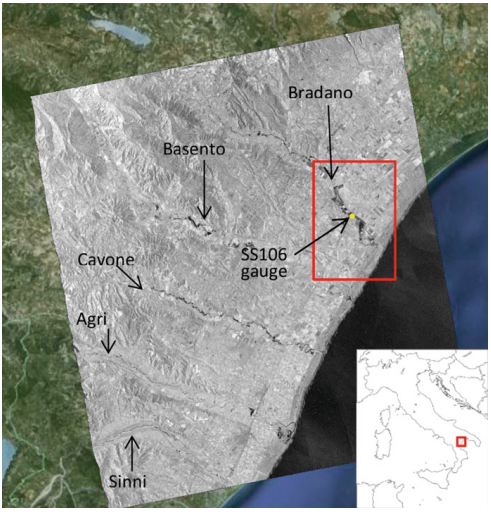
Producing high-precision flood maps requires integrating and correctly classifying information coming from heterogeneous sources. Methods to perform such integration have to rely on different knowledge bases. A useful tool to perform this task consists in…
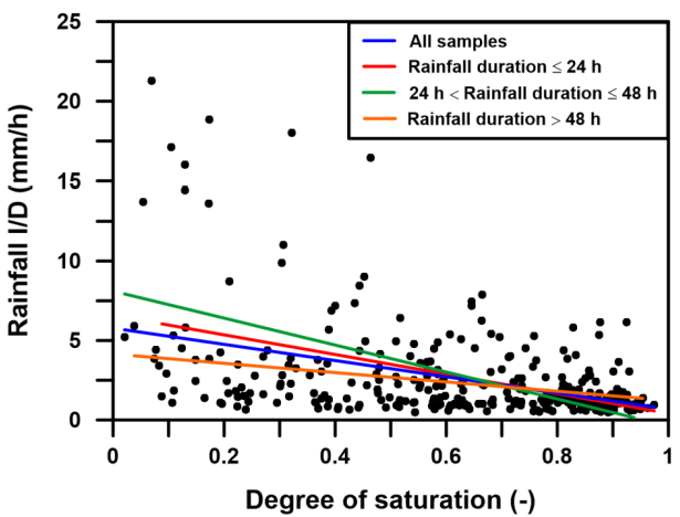
Rainfall-triggered shallow landslides have caused losses of human life and millions of euros in damage to property in all parts of the world. The need to prevent such phenomena combined with the difficulty to describe…
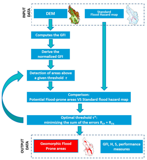
Delineation of flood hazard and flood risk areas is a critical issue, but practical difficulties regularly make complete achievement of the task a challenge. In data-scarce environments (e.g. ungauged basins, large-scale analyses), useful information about…